Archive Record
Images


Metadata
Object # |
2012.027.001 |
Object Name |
Map |
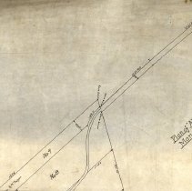
Description |
A Plan of Allen's Point in Marion, MA. as surveyed and drawn by John M. Allen of Marion, MA. in1903. Scale is 1/8" = 1 Rod. |
Search Terms |
Allen's Point Maps |
People |
Allen, John M. |
Creator |
Allen, John M. |
Date |
1903 |
Category |
8: Communication Artifact |
Sub-category |
Documentary Artifact |
Accession number |
2012.027 |