Search Term Record
Metadata
Name |
Maps |
Number of Archive records |
32 |
Number of Library records |
0 |
Number of Photo records |
8 |
Number of Object records |
1 |
Related Records
-
-
-
-
-
-
-
-
2008.007.009 - Digital image
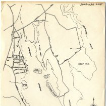
This map shows 1680 Rochester had 14 tenants on Little & Great Neck
Record Type: Photo
-
-
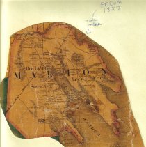
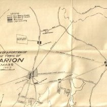
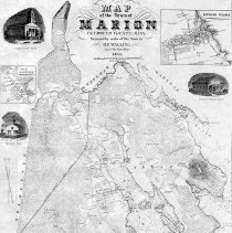
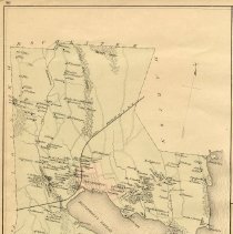
2009.020.007 - Map
A map of the Town of Marion, Massachusetts (2 Copies) undated
Record Type: Archive
-
2011.005.001 - Map
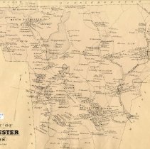
A sepia map of the Town of Rochester, Mass. It measures 16" wide by 12" high and is identified as Page 85.
Record Type: Archive
-
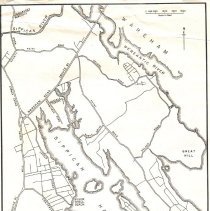
2011.005.002 - Map
A color map of the Town of Wareham and Marion, Mass. identified as page 86 . It measures 12" wide by 18" high. (2 copies)
Record Type: Archive

-
2011.005.003 - Map
A color map of the Village of Wareham Narrows, Town of Wareham identified as page 87. It measures 7 5/8" wide by 16" high.
Record Type: Archive
-
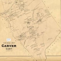
2011.005.004 - Map
A sepia map of the Town of Carver, Mass. identified as Page 88. It measures 13 5/16" wide by 17 3/4" high.
Record Type: Archive
-
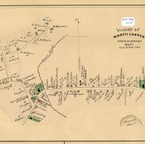
2011.005.005 - Map
A color map of the Village of North Carver, Town of Carver, Mass. identified as Page 89. It measures 12 1/8" wide by 8" high.
Record Type: Archive
-
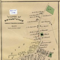
2011.005.006 - Map
A color map of the Village of Bryantville, Towns of Pembroke & Hanson, Mass. identified as Page 89. It measures 5 1/2" wide and 8" high.
Record Type: Archive
-
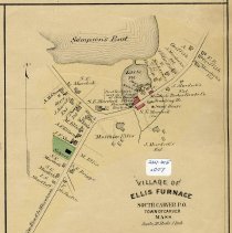
2011.005.007 - Map
A color map of the Village of Ellis Furnace, South Carver P.O., Town of Carver, Mass. identified as Page 89. It measures 6 1/2" wide by 8" high.
Record Type: Archive
-
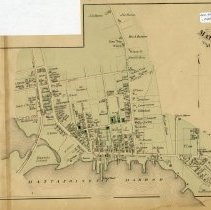
2011.005.008 - Map
A color map of the Town of Mattapoisett, Mass. identified as Page 90. It measures 9 7/8" wide by 16" high.
Record Type: Archive
-
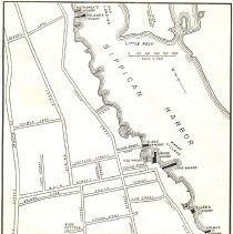
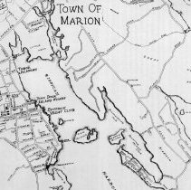
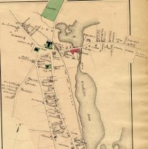
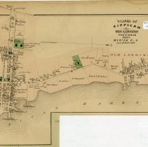
2011.005.009 - Map
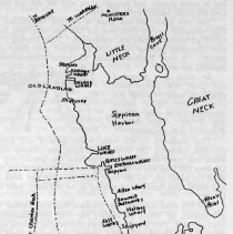
A color map of the Village of Sippican & Old Landing, Town of Marion, Mass. identified as Page 91. It measures 15 3/4" wide and 9 1/2" high.
Record Type: Archive
-
2011.005.010 - Map
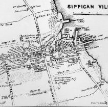
A color map of the Village of Mattapoisett, Town of Mattapoisett, Mass. identified as Page 91. It measures 16" wide by 9 1/2" high.
Record Type: Archive